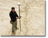
Accuracy of data is always important. When it comes to utility mapping, even though 1-2ft are added to markings ( from the actual identified utility location) just for safety reasons, using an adequate GPS unit ( from an accuracy stand point) will make a big difference no matter how digital data is being used ( CAD or GIS overelays for site plans/ excavation reference/…) Therefore, using a standard GPS unit that integrates with your locating equipment ( 90% of the time this is what’s being used by locating companies ) will allow you to capture data with a 1-5m accuracy . We, at Advanced Mapping, believe that such accuracy introduces too much error ( additional 3-15ft added to your initial 2ft added for safety reasons) and recommend using sub-foot accuracy for capturing locating markings. The sub-foot accuracy is the perfect accuracy level from a practical and financial perspective. While your standard GPS unit has an accuracy of 1-5 m, survey-grade GPS not only is more expensive but it is also a little of an …. “overkill” ( using cm-level accuracy to capture foot-level markings).
In conclusion, if you want to locate utilities and are in need of digital data (and why wouldn’t you ? ) we recommend hiring a locating company to do the locating and a mapping company to take care of the mapping task!
Why Advanced Mapping? It’s simple: we specialize in GIS & GPS solutions and we actually enjoy what we are doing! It’s easy to do a good job when you care and love your job! Please give us a call. Quick turnaround, integrity and quality is what all our customers experience!

Please feel free to contact us with any GIS or GPS related questions.
